About our aerial imagery
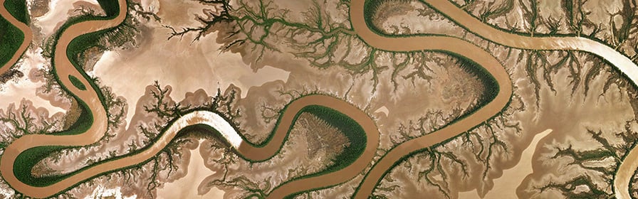
Aerial photography is the oldest form of remote sensing and as it predates satellite imagery, it represents a valuable source of historic data. A major advantage of aerial imagery is that planes can fly at different altitudes and capture imagery at different resolutions.
Generally aerial imagery is used for the creation and updating of topographic maps. Land-use studies often rely on old black and white aerial photographs for compiling land-use histories.
Aerial imagery options
Orthorectified aerial imagery is aerial photography that has been geometrically corrected. Check the ortho-mosaic index to locate and check the coverage status of a specific area.
Custom aerial imagery extracts can be ordered from Landgate's extensive imagery repository, including our most recent acquisitions. Find out more about custom aerial imagery extracts.
Spatial resolutions
The resolution of the aerial imagery provided by Landgate is usually less than 1m. Cities and townsites are usually captured at 10 or 15cm. Broad area coverage is usually 50cm. Landgate has aerial imagery over the Perth metropolitan area from 1948 onwards. However, there are some parts of the state that have only been flown once in the past 70 years.
Availability and access
Map Viewer Plus is an online viewing tool offering current and historical aerial imagery, along with layers of geographic information. Map Viewer Plus now services the surveying industry by the inclusion of authoritative geodetic and survey information. If you’re new to Map Viewer Plus our ’how to use’ guide will help you to navigate its options.
Shared location information platform (SLIP)
Delivered by Landgate on behalf of the State Government, SLIP is a platform for sharing location-based (or spatial) information. it is a key mechanism in supporting the State’s Open Data Policy. Dozens of government agencies use SLIP to provide location information to the public, researchers, business and government. Check the SLIP Locate mapping platform here.
Public sector agencies can visit Capture WA to register and submit requests for a range of satellite and aerial imagery.
Price
| Format | Price |
| JPEG | $26.50 plus $0.58 per MB |
| ECW/GeoTIFF/JPEG 2000 | $88 plus $0.58 per MB |